The Yarlung Tsangpo Grand Canyon, situated in the Qinghai-Tibet Plateau, is an exceptional natural wonder. Often called the “Roof of the World,” this immense geological formation is the largest and deepest canyon on Earth. Its formation is an extraordinary story of internal and external geological forces sculpting a distinctive landscape.
What is the World’s Largest Canyon?
The Birthplace of a Geological Marvel: Yarlung Tsangpo Grand Canyon
On the renowned Qinghai-Tibet Plateau, a region renowned as the “Roof of the World,” lies a verdant corridor. This corridor traces the path of the Brahmaputra River, known as the Yarlung Zangbo River, as it winds southeastward through two high valleys at altitudes exceeding 6,000 meters. This course forms a distinctive U-shaped bend, cradling the Namchakbarwa Peak. The resulting spectacle is a grand masterpiece of nature—the Brahmaputra Grand Canyon.
According to data from the National Bureau of Surveying and Mapping, the Grand Canyon commences at Daduka Village in Payi Town, Milin County, with an elevation of 2,880 meters to the north. It proceeds through the great bend of the Yarlung Zangbo River in Pailong Township and concludes at Basika Village, Medog County, in the south, near Assam, India. The total length of this grand canyon spans 504.6 kilometres, with a profound depth reaching 6,009 meters and an average depth of 2,268 meters.
Indeed, it claims the title of the world’s most colossal canyon, surpassing the likes of the Parung Tsangpo Grand Canyon, the Colorado Grand Canyon in the United States, and Peru’s Colca Grand Canyon. The Yarlung Tsangpo Grand Canyon contains nine vertical natural zones, ranging from alpine ice and snow to tropical rainforests, so it is the place with the most complete alpine vertical natural zones in the world.

Causes and Effects of the Brahmaputra River Grand Canyon:
Unravelling Nature’s Masterpiece
Why has the Brahmaputra Grand Canyon earned its reputation as the largest, deepest, and most magnificent canyon globally? To understand this geological marvel, we must delve into the geographical location and related geological knowledge that underpins its formation. Scientific investigations reveal that the Yarlung Zangbo Grand Canyon owes its existence to the dynamic interplay of the Himalayan mountain range and the erosive might of its rivers.
This remarkable transformation can be summarized in two stages. First, the uplift phase is triggered by the internal forces of tectonic plate movement. The formation of the Yarlung Zangbo Grand Canyon can be attributed to the rapid crustal uplift in the area over the past 3 million years, with the region experiencing one of the world’s swiftest rates of uplift—30 mm/year in the past 150,000 years.
Geological surveys have uncovered evidence pointing to the presence of upwelling asthenospheric mantle bodies as the fundamental reason for the Grand Canyon’s formation. The geological features of the Yarlung Zangbo Grand Canyon closely parallel those of the Colorado Grand Canyon in the United States.
Geological marvel of Yarlung Tsangpo
The second critical stage is that of external erosion and scouring. This is what has sculpted the Grand Canyon’s undulating landscapes into the spectacle we witness today. The Brahmaputra River, fed by abundant precipitation and glacial meltwater, has been instrumental in creating significant variations in altitude within this fault zone. The valley floors on both sides underwent erosion and scouring, leading to the formation of a large horseshoe-shaped bend due to geostrophic deflection.
The formation of the Brahmaputra River Canyon has left a profound imprint on our planet’s natural geographical environment. It has an impact on diverse aspects, including climate, geology and landforms, and natural zones (biology). To gain a comprehensive understanding of the Grand Canyon’s significance, it’s imperative to analyze these facets and implement measures to protect the local natural environment.
The Remarkable Journey of the Yarlung Tsangpo River
The Brahmaputra River ranked as the seventh largest river in China and part of the vast Indian Ocean water system, embarks on a fascinating odyssey. Its story commences at the Genma Yangzong Glacier, nestled at the northern foothills of the mighty Himalayas in southwestern Tibet. In its upper reaches, it is known as the Horse River, snaking its way through the rugged terrain of southern Tibet from west to east. It encounters the easternmost tip of the Himalayas, where the formidable Namjagbarwa Peak stands. Here, the river takes a dramatic southward turn before making its exit from Tibet through Basika.
Upon departing from the Tibetan plateau, the river enters the Indian state of Assam and assumes the name of the Brahmaputra River. As it journeys further, crossing into Bangladesh, it adopts the title of the Jamuna River. Ultimately, in Bangladesh, it converges with the Ganges, uniting to form the largest river delta in the world before finding its way into the embrace of the Bay of Bengal. This is the awe-inspiring narrative of the Brahmaputra River, a testament to the magnificent forces of nature.

Embarking on a Grand Geological Adventure
The Brahmaputra River, with its astounding canyon, offers a unique avenue for tourism on the Qinghai-Tibet Plateau. It’s also a haven for geographical study, travel, and scientific research. However, potential visitors should take heed of the timing—hiking the Brahmaputra Grand Canyon is best undertaken from early June to mid-October. After October, due to heavy snowfall, Medog County closed its mountain roads, rendering access impossible until the following June. April and October emerge as the prime seasons to explore Medog, characterized by lower rainfall in the Grand Canyon region and a diminished risk of landslides or mudslides.
During the rainy season from June to August, certain routes to and from Medog can become perilous. Therefore, if you have the courage and desire to explore the Brahmaputra Grand Canyon during the summer vacation, seize the opportunity quickly!
Unveiling the Geological Enigma of the Yarlung Tsangpo Grand Canyon
The Yarlung Tsangpo Grand Canyon is a world-class scenic spot in Tibet. Once a treacherous canyon concealed in inner Tibet, it has now been “rediscovered” as a new and thrilling tourist destination in the eastern part of the world.
In Tibetan, “Yarlung Tsangpo” means water flowing down from the summit. The Yarlung Tsangpo Grand Canyon, covered in ice and snow, embraces the mountains and peaks in the Namchak Barwa Peak area. It serves as a passage for moisture from the Indian Ocean to the inner mountainous region, creating a green oasis in the southeast of the Qinghai-Tibet Plateau.
The canyon boasts the most diverse mountainous ecosystem in the world, ranging from tropical to polar regions. Rare species found in the canyon include the fern erne tree, moss, Yunnan iron cedar, giant boa, Bangladesh tiger, long-leaf tail monkey, and bear monkey. In 1994, scientists from the Chinese Academy of Science confirmed it as the largest canyon in the world, which was later supported by GPS measurements in October and November 1998. On October 10th of that year, the State Council of China officially named it “Yarlung Tsangpo Grand Canyon.”

Historical Journeying of the Yarlung Tsangpo Grand Canyon
The sophisticated stone wares found in the canyon (similar to those unearthed in the northern steep of the Himalayas) suggest that 5,000 to 8,000 years ago here was not only a habitat for the Tibetan ancestors but also an important passage to connect people on the highland and those from the low areas. Nowadays there still live thousands of Luoba and Menba people in the harsh roof of the world. The preservation of their traditional customs and cultures, such as their tribe totems, witchcraft, and religious rituals, is highly appreciated as a piece of precious living archaeological fossils.
Location: The Geological Marvel of the Brahmaputra Grand Canyon
The Yarlung Tsangpo Grand Canyon is located in the southeast of the Nyingchi Prefecture, where the Himalaya, Tanggula, and Henduan Mountains converge. It begins in Milin County, extends eastward, then turns south at the Namchak Barwa Peak, before continuing southward to Xilang in Methok County. Stretching approximately 496.3 km, the canyon has an average depth of 5,000 meters, with its deepest point reaching 6,009 meters. The core section of the canyon has an average depth of 2,673 meters. The highest elevation difference on one side is 7,057 meters, and the narrowest section measures only 35 meters. With a latitude exceeding 3,000 meters, it is the world’s foremost Grand Canyon.
Related posts:
 Yarlung Tsangpo River: The Longest Plateau River in the World
 Exploring Qilinxia Grand Canyon: A Hidden Gem in Tibet
 Brahmaputra River
 Mount Namcha Barwa
 Unveiling the Charms of Sarang and Diya Town, Langchen Tsangpo, Ngari
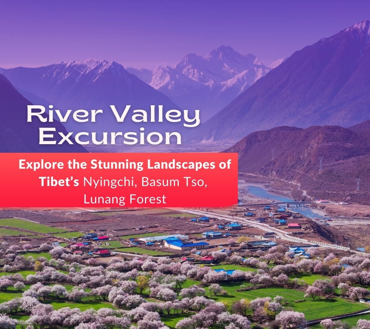
 Discover the Enchanting Beauty of Linzhi: the Peach Blossoms in Tibet
Rediscover Yading: A Popular Haven Amidst the Clouds
Discover the Enchanting Beauty of Linzhi: the Peach Blossoms in Tibet
Rediscover Yading: A Popular Haven Amidst the Clouds
 Discovering the Mesmerizing Ranwu Lake: Hidden Jewel in Tibet
 Nyingchi to Lhasa Train will take only three hours, along with the beautiful scenery!
 Yamdrok Yumtso: Exploring the Pristine Beauty of Tibet’s Celestial Lake