Exploring the Majestic Himalayas: The Jewel of the Tibetan Plateau
Introduction to the Himalayan Range
Nestled on the southern fringe of the Tibetan Plateau, the Himalayas are not just any mountain range; they are a spectacle of nature stretching east to west along the borders of China, India, and Nepal. This vast range, spanning a remarkable 2,400 kilometers in length and about 200-300 kilometers in width, is a must-visit for adventure enthusiasts and nature lovers alike.
Unveiling the Sections of the Himalayas
The Himalayas consist of several parallel ranges, each unique in its own right. Three distinct sections are:
- The Siwalik Hills – The outermost range of the Himalayas, offering lush greenery and a series of rolling hills.
- The Lesser Himalayas – Known for their rugged terrain and picturesque landscapes, perfect for trekking.
- The Greater Himalayas – The most prominent section, where the giants of the mountain world, including Mount Everest, stand tall.
With an average elevation soaring above 6,000 meters, these ranges collectively present a breathtaking panorama.
Mount Everest: The Pinnacle of the Himalayas
Mount Everest, the world’s highest peak at a staggering 8,848.86 meters, is the crowning glory of the Himalayas. Straddling the border between China and Nepal, it attracts climbers and adventurers from around the globe, all aiming to conquer its summit.

The Gangdise-Nyenchen Tanglha Range: Tibet’s Natural Barrier
Journeying further into Tibet, the Gangdise-Nyenchen Tanglha range emerges as a significant landmark. Stretching approximately 1,400 kilometers from east to west, it averages 80 kilometers in width and boasts an average elevation of about 6,000 meters. This range forms a natural division between northern and southern Tibet and plays a crucial role in separating Tibet’s river systems.
Iconic Peaks of the Gangdise-Nyenchen Tanglha Range
Within this range lie two notable peaks:
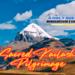
- Mount Gang Rinpoche (6,714 meters): A revered peak in Tibetan Buddhism.
- Mount Nyainqêntanglha (7,117 meters): Known for its stunning views and spiritual significance.
Discovering the Karakoram Range: A Geographic Wonder
Introduction to the Karakoram Range
The Karakoram Range, a remarkable geographical feature on the northwestern edge of the Tibetan Plateau, is a convergence point for some of the world’s most famous mountain ranges. It connects the Pamir Plateau, the Himalayas, and the Tanggula Mountains. Standing as the world’s second-highest mountain range, the Karakoram is home to the majestic K2, which soars to an impressive 8,611 meters.
K2: The Crown of the Karakoram
K2, the pinnacle of the Karakoram Range, is not only renowned for its height but also for its challenging terrain, making it a coveted peak for mountaineers globally. Serving as an essential gateway, the Karakoram Pass has been a key trade route linking Xinjiang and Kashmir. This pass holds significant historical and geopolitical importance.
Climatic Influence and Glaciation
Unique in its climatic influences, the Karakoram is shaped by both the Indian Ocean monsoon and the westerlies. This dual influence has led to the formation of the largest mid-latitude glaciation on Earth, making it a study of interest for climatologists and geographers.
The Tanggula Range: A Natural Divider
Geography of the Tanggula Range
Nestled in the central Tibetan Plateau, the Tanggula Range forms a natural boundary between the Tibet Autonomous Region and Qinghai Province. Connecting with the Karakoram in the west, it stretches southeast towards the Hengduan Mountains.
The High Peaks and Natural Beauty of Tanggula
The Tanggula Range boasts its highest peak, Geladaindong, at 6,621 meters. Notably, this peak is the source of the Yangtze River, one of China’s most significant rivers. The range is characterized by its vast expanses, numerous valleys, and lush natural pastures, offering a picturesque landscape.
Both the Karakoram and Tanggula Ranges offer more than just high-altitude experiences. They are a journey through diverse landscapes, rich cultural histories, and unique climatic phenomena. For adventurers, geographers, or those simply in awe of nature’s wonders, these ranges provide an unparalleled exploration opportunity.
The Kunlun Mountains: Asia’s Majestic Spine
Overview of the Kunlun Mountains
Dominating the northern Tibetan Plateau, the Kunlun Mountains, known as the “Backbone of Asia,” mark the divide between the Tibet Autonomous Region and the Xinjiang Uyghur Autonomous Region. These mountains stretch over 2,500 kilometers in length and around 150 kilometers in width, with elevations generally ranging from 5,500 to 6,000 meters.
A Realm of Snow and Ice
The Kunlun Mountains are renowned for their extensive snowfields and glaciers. The snowline typically lies between 5,400 and 5,800 meters, contributing to a substantial area of permanent snow cover. The upper region of the Yulongkash River alone blankets over 3,000 square kilometers. The mountains boast nearly a thousand glaciers, with the longest extending up to 25 kilometers.
The Hengduan Mountains: Eastern Barrier of the Tibetan Plateau
Geographic Profile of the Hengduan Mountains
The Hengduan Mountains, positioned on the eastern edge of the Tibetan Plateau, traverse through eastern Tibet, western Sichuan, and Yunnan. This range is noted for its significant north-to-south elevation variation, with northern peaks averaging around 5,000 meters and southern peaks dropping to about 4,000 meters.
Rugged Terrain and Biodiversity
Characterized by its rugged topography, the Hengduan Mountains feature deep valleys and steep mountains, with elevation differences between ridges and valleys reaching 1,000 to 2,500 meters. The northern part maintains extensive plateau surfaces, ideal for summer pastures. In contrast, the southern section is marked by craggy ridges and rapid rivers.
Celebrating Geographical Wonders
The Kunlun and Hengduan mountain ranges are not only significant geographical landmarks but also cultural and natural treasures. Their high elevations, diverse ecosystems, and historical importance make them fascinating subjects for geographers, climbers, and environmentalists. These mountain ranges are emblematic of the rich, varied landscapes that define the Tibetan Plateau, offering a unique blend of natural beauty and cultural heritage.