Tibetan people
Tibetan Customs
Major Festivals in Tibet
Tibetan Language
A Tibet travel map is an essential tool that integrates tourist attractions, transportation routes, and administrative divisions across the vast Tibetan Plateau. Different Tibet tourism maps may emphasize different details, but overall they can be understood through several core dimensions: basic geographic structure, regional attraction distribution, transportation routes, and practical travel information.
Using the right map helps travelers quickly locate destinations, understand travel distances, and plan realistic itineraries in high-altitude regions.
Most Tibet tourism maps clearly present Tibet’s overall geographic position and administrative boundaries. These maps show Tibet’s borders with surrounding Chinese provinces as well as neighboring countries in South Asia.
| Administrative Level | Name |
|---|---|
| Provincial Region | Tibet Autonomous Region |
| Prefecture-level Cities | Lhasa, Shigatse, Nyingchi, Shannan, Chamdo, Nagqu |
| Prefecture | Ngari (Ali Prefecture) |
On many official maps—such as those based on Tianditu (Map World)—administrative boundaries form the base layer, with scenic attractions added on top. This allows travelers to instantly identify which attractions belong to which city or prefecture.
| Geographic Feature | Examples Commonly Shown on Maps |
|---|---|
| Major Rivers | Yarlung Tsangpo River, Nujiang River |
| Mountain Ranges | Himalayas, Gangdise Range |
| Lakes | Namtso, Yamdrok Lake, Manasarovar |
| Elevation Data | Average altitude, key high passes |
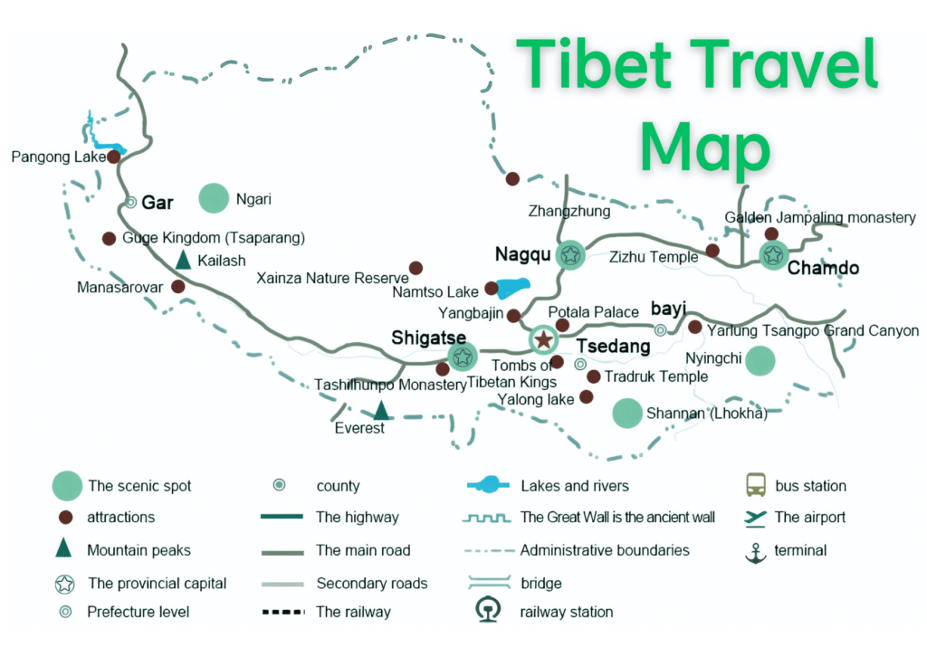
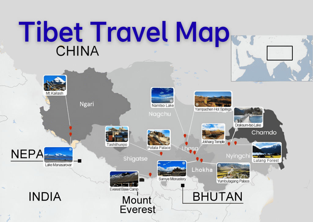

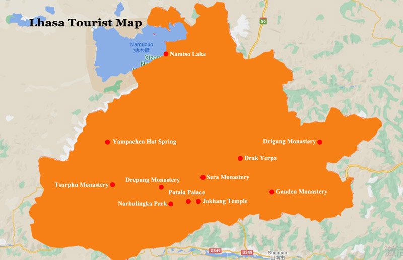
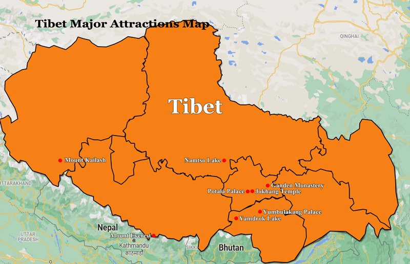
As the heart of Tibetan culture, Lhasa is always heavily detailed on Tibet travel maps.
| Area | Key Attractions Marked |
|---|---|
| Lhasa City | Potala Palace, Jokhang Temple, Barkhor Street |
| Suburban Monasteries | Drepung Monastery, Sera Monastery, Ganden Monastery |
| Northern Lhasa | Namtso Lake (Damxung–Baingoin border) |
Potala Palace is typically marked with a distinct palace icon on Red Hill, while Jokhang Temple is shown at the center of Barkhor Street, helping travelers visualize walking routes within the old city.
Shigatse travel maps focus on both border regions and the city center.
| Location | Highlighted Sites |
|---|---|
| Border Area | Everest Base Camp, Rongbuk Monastery |
| Scenic Viewpoints | Gawula Pass |
| Shigatse City | Tashilhunpo Monastery |
| Surrounding Counties | Sakya Monastery, Pekutso Lake, Mount Shishapangma |
These precise markings are especially helpful for travelers combining Himalayan scenery and religious heritage.
Known for its lower altitude and lush landscapes, Nyingchi (Linzhi) maps emphasize natural attractions along highways and river valleys.
| Attraction Type | Popular Sites Marked |
|---|---|
| Villages & Valleys | Gala Peach Blossom Village |
| Forest Landscapes | Lulang Forest |
| Mountain Passes | Sejila Mountain Pass |
| Lakes & Glaciers | Basumtso Lake, Rawok Lake, Laigu Glacier |
Basumtso Lake is usually marked within Gongbo’gyamda County, with nearby villages labeled to help travelers plan overnight stays.
In western and northern Tibet, maps focus on iconic landmarks adapted to rugged terrain.
| Region | Key Features on Maps |
|---|---|
| Ngari (Ali) | Mount Kailash, Lake Manasarovar |
| Nagqu | Northern Namtso areas, grasslands |
| Chamdo | Nujiang (Salween) River Gorge |
These regions are often marked with terrain-specific icons to indicate remoteness and long driving distances.
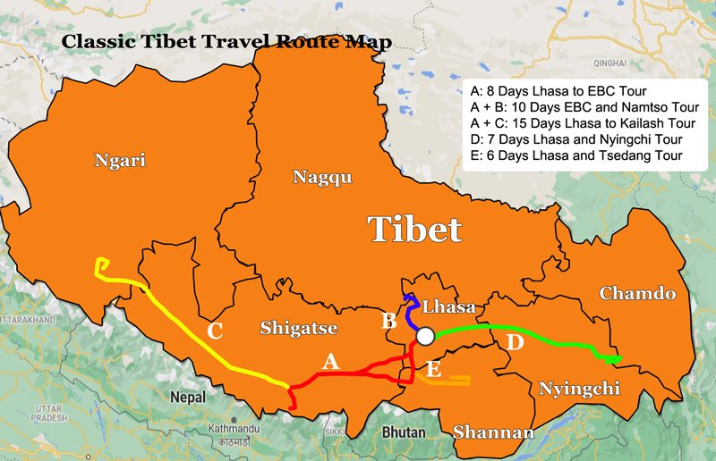
A practical Tibet road map provides detailed guidance on both entry routes and internal transportation.
| Route Name | Common Map Label | Key Notes |
|---|---|---|
| Sichuan–Tibet Highway | G318 | Scenic, high passes marked with altitude |
| Qinghai–Tibet Highway | G109 | Gradual ascent, popular for first-time travelers |
| Xinjiang–Tibet Highway | G219 | Remote, long-distance route |
Many maps highlight altitude points and kilometer markers, especially along the G318 route.
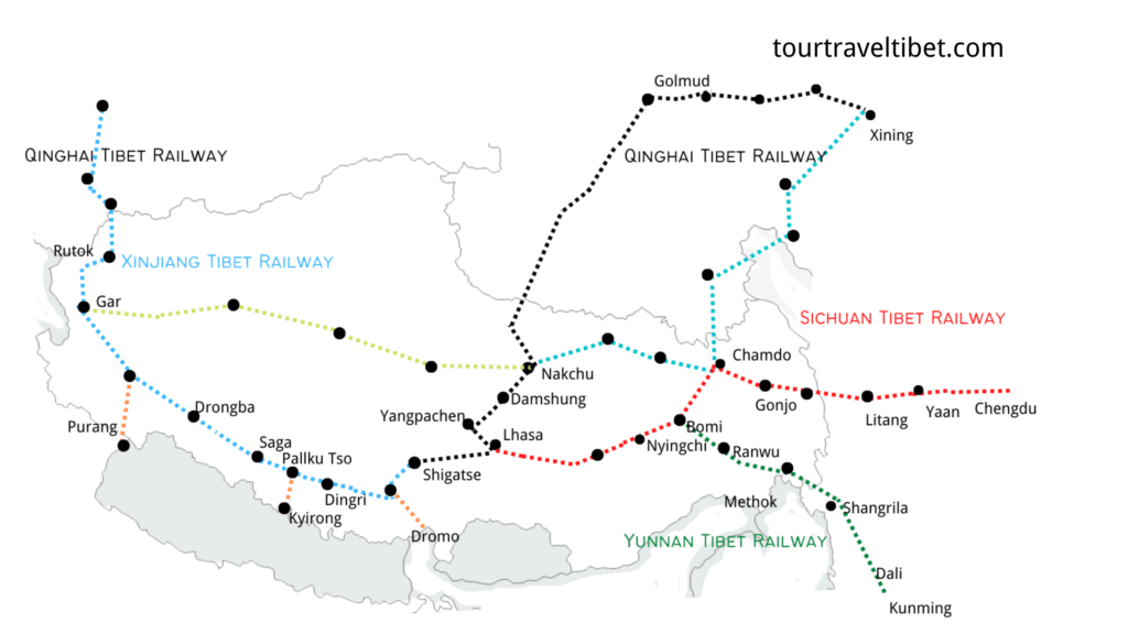
| Transport Type | Routes Commonly Shown |
|---|---|
| Railway | Lhasa–Shigatse Railway |
| Highways | Lhasa–Nyingchi Road |
| Urban Access | Ring roads around Lhasa city |
Some upgraded Tibet travel maps also mark fuel stations, supply towns, and accommodation clusters, which are crucial for self-drive or long-distance travel.
Tibetan cuisine is a reflection of the region’s unique culinary culture, characterized by staples like butter, tea, Tsampa (roasted barley flour), beef, and mutton—referred to as the “four treasures” of Tibetan cuisine. Additionally, Tibet is renowned for its highland barley wine and a variety of traditional dishes that delight the palate and offer a glimpse into the rich gastronomic heritage of the region.
In every aspect, Tibet enchants with its natural beauty, cultural richness, and culinary delights, inviting travellers on a journey of discovery and wonder amidst the roof of the world.
Many modern or portable Tibet tourism maps include extra features designed for convenience and safety.
| Map Feature | Travel Benefit |
|---|---|
| Chinese–English Names | Easy navigation for international travelers |
| Ticket Price References | Quick budgeting for attractions |
| Hand-drawn 3D Style | Better understanding of terrain |
| Nature Reserve Boundaries | Awareness of environmental rules |
| Road Warnings | Alerts for dangerous or construction zones |
Some self-drive maps also include suggested 7–10 day itineraries printed on the reverse side, listing daily routes, attractions, and accommodation areas.
With over 1,500 lakes, Tibet holds the distinction of having the most lakes in China, covering 30% of the country’s total lake area. Nestled amidst the rugged mountainous terrain, these lakes range from freshwater to saltwater bodies, surrounded by lush pastures and inhabited by rare wildlife. Among the revered lakes are Namtso, Yamdrok Lake, Manasarovar Lake, Pangong Lake, Basong Co, and Senli Co, with Namtso, Manasarovar, and Yamdrok renowned as the three “holy lakes” holding profound religious significance.
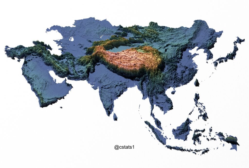
Tibet’s allure lies in its awe-inspiring topography, characterized by mighty rivers such as the Yangtze, Nu, Lancang, and Brahmaputra. The region boasts diverse landscapes, from towering mountains to deep gorges, vast glaciers, unique rock formations, and expansive deserts. Geographically, Tibet encompasses the Himalayas, Tibetan valleys, the vast Tibetan plateau, and mountainous canyons in the east.