On January 7, 2025, at 9:05 AM Beijing time, a 6.8 magnitude earthquake struck southwest of Dingri County in Tibet’s Shigatse Prefecture. The earthquake had a shallow depth of 10 kilometers, with the epicenter located at 28.50°N, 87.45°E. The quake was felt as far away as Nepal, Bihar in India, and other neighboring regions, highlighting the seismic activity of the Tibetan Plateau. Below are key insights into this event and its implications.
Epicenter Location and Impacted Area
- Proximity to Key Locations:
The epicenter is situated 34 km from Dingjie County, 36 km from Dingri County, 67 km from Lazi County, and 71 km from Sakya County. It is 164 km from Shigatse City and 379 km from Lhasa. - Population Density:
Contrary to assumptions about high-altitude areas, the region is not sparsely populated. Within 5 kilometers of the epicenter, seven villages—Tangren, Xuezhu, Gare Guoji, Meiduo, Chaji, Lachang, and Kangqiong—are home to over 5,200 residents. Extending to a 10-kilometer radius, the population increases to around 7,000, and within 20 kilometers, there are over 10,000 people. - Geography:
The epicenter lies within the Pangchu River valley, a relatively flat and accessible area. The valley’s open terrain is favorable for rescue operations, with National Highway 219 passing through the affected zone. - List of Aftershock Check here
Historical Earthquakes in the Region
The Tibetan Plateau is one of the most seismically active regions in the world, primarily due to the ongoing collision between the Indian and Eurasian tectonic plates. Key past events include:
- 1833 Nyalam Earthquake:
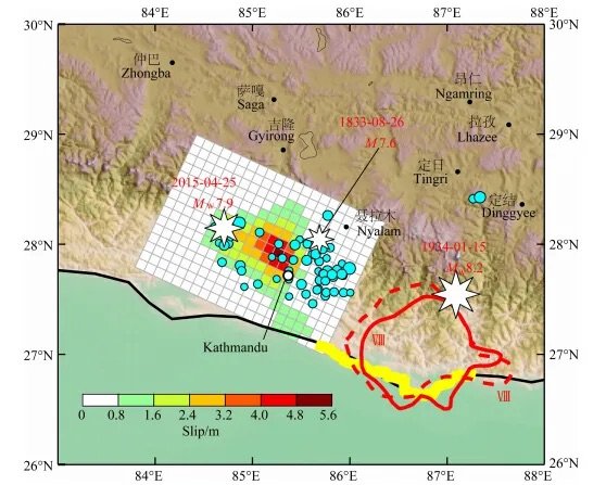
A devastating 7.6 magnitude earthquake caused significant loss of life in Tibet. - 2015 Nepal Earthquake:
This 7.8 magnitude quake killed nearly 8,800 people in Nepal and injured over 22,000. It also caused casualties in Tibet, India, Bangladesh, and Bhutan. - 2020 Dingri Earthquake:
A 5.9 magnitude earthquake struck Dingri County, prompting experts to warn of increased seismic activity in the area.
Major Earthquakes in Tibet and Surrounding Regions (1833–2025)
| Year | Earthquake | Date | Magnitude | Epicenter | Impact |
|---|---|---|---|---|---|
| 1833 | Nyalam Earthquake | August 26, 1833 | 7.6 | Nyalam County, Tibet (130 km from Dingri) | – Severe destruction in Nyalam, Dingri, Gyirong – Nepal: 18,000 houses destroyed, 414 deaths. – India: Damage in several areas. |
| 2015 | Nepal Earthquake | April 25, 2015 | 7.9 | Near Pokhara, Nepal (70 km northwest of Kathmandu) | – Nepal: Nearly 8,800 deaths, 22,300 injuries, and widespread destruction in Kathmandu. – Tibet: 27 deaths, 860 injuries in Gyirong and Nyalam; 300,000+ affected in Shigatse; economic losses of 10 billion yuan. – Mount Everest: Avalanche killed 18 climbers, mountain shifted 3 cm southward, height decreased by 2.5 cm. – Aftershocks: 5.9 (Dingri) and 5.3 (Nyalam); May 12: Mw 7.3 quake near epicenter. |
| 2020 | Dingri Earthquake | March 20, 2020 | 5.9 | Pangchu River Valley, Dingri County (28.63°N, 87.42°E) | – Highlighted rising seismic activity after the 2015 Nepal earthquake. – Caused by compressive forces from the Indian Plate pressing against the Eurasian Plate. |
| 2025 | Tingri Earthquake | January 7, 2025 | 6.8 | Tingri County, Tibet (28.50°N, 87.45°E) | – Shallow depth (10 km) caused severe surface-level damage. – Significant tremors felt in surrounding regions, including Shigatse and Lhasa. |
Geological Context and Predictions
- The Himalayan seismic belt has a history of major earthquakes, such as:
- 1934 Nepal Earthquake: Mw 8.2
- 1950 Assam-Tibet Earthquake: Mw 8.4
- Post-2015 analysis shows:
- Energy release from recent earthquakes was lower than expected.
- Seismologists warn of moderate to large potential earthquakes east of the 1934 rupture zone.
The Collision of the Indian and Eurasian Plates
Plate Movement
- The Indian Plate moves northward at a rate of 3.6-4.5 cm per year, subducting beneath the Eurasian Plate.
- This collision has given rise to the Himalayan mountain range and the Tibetan Plateau, while accumulating immense crustal stress, leading to frequent seismic activity.
Geological Structure of the Tibetan Plateau
Complex Geology
- The Tibetan Plateau consists of multiple tectonic blocks stitched together by faults and suture zones.
- Active fault zones, such as the Gyala-Thingri Fault, are common sources of earthquakes in the region.
Seismic Statistics
Historical records indicate that the Tibetan region has experienced:
- 4 earthquakes above magnitude 8.0
- 11 earthquakes of magnitude 7.0-7.9
- 86 earthquakes of magnitude 6.0-6.9
Seismic Context of the Tibetan Plateau
The Tibetan Plateau experiences frequent and powerful earthquakes due to the annual subduction of the Indian Plate beneath the Eurasian Plate. Over the past 200 years, numerous earthquakes exceeding magnitude 8 have occurred in the region, emphasizing the need for robust disaster preparedness.
Challenges and Response Needs
- High-altitude Conditions:
The average elevation of the epicenter area is about 4,260 meters. During winter, temperatures drop significantly, with Dingri County recording -13°C at the time of the quake. Most residents were indoors due to the freezing conditions, increasing the risk of injuries. - Disaster Preparedness:
The earthquake highlights the urgent need for:- Earthquake-resistant infrastructure: Ensuring buildings can withstand high-magnitude quakes.
- Public awareness campaigns: Educating residents about emergency responses in seismically active zones.
- Streamlined rescue operations: Leveraging the relatively accessible terrain for faster response times.
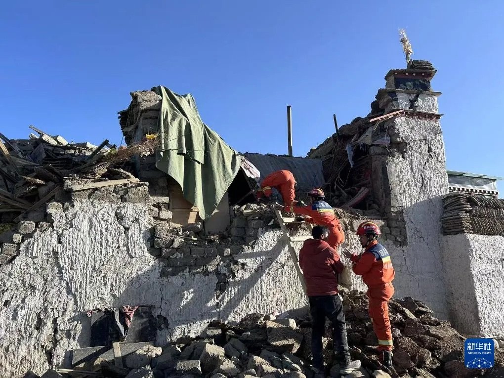
Damage and Casualties
- Structural Impact:
- In Dingri County, 36 km from the epicenter, many newer buildings have developed cracks.
- Older, simpler structures have collapsed, leading to significant casualties.
- The Pangchu River valley, due to its geological amplification effects, experienced higher seismic intensity, worsening the damage in localized areas.
- Casualties:
- By 3:00 PM on January 7, the earthquake had caused 95 fatalities and 130 injuries, according to official reports.
- The region mourns the loss of lives and extends condolences to the affected families.
Major Earthquakes in Tibetan History
1950 Assam-Tibet Earthquake (Mw 8.6)
- Magnitude: Sixth strongest earthquake of the 20th century.
- Impact:
- The towns of Motuo and Zayul were in the 10 and 11 intensity zones, respectively.
- Houses collapsed entirely, landslides reshaped the landscape, and several villages were swept into the Yarlung Tsangpo River by landslides.
- Casualties: 1,526 deaths in Tibet, nearly 1,500 deaths in India.
1951 Dangxiong Earthquake (Mw 8.0)
- Followed by a 7.5 magnitude earthquake in 1952, which caused:
- The collapse or damage of 774 houses.
- 54 fatalities.
Rescue and Relief Efforts
- Swift Mobilization:
- Within 15 minutes of the quake (9:20 AM), Tibet’s forest firefighting teams, including units from Shigatse, Nakchu, and Special Operations, deployed 15 personnel with 3 vehicles towards the epicenter.
- Additional support from the Tibet Autonomous Region Forest Fire Brigade included 215 personnel with 13 vehicles heading to the affected area.
- Military Involvement:
- The Western Theater Command Air Force launched an emergency response plan.
- One drone was dispatched for disaster assessment, and transport planes, medical aircraft, helicopters, and ground forces were placed on standby for relief operations.
Weather Challenges
- Forecast for January 7–9:
- Clear skies but harsh winter conditions, with nighttime lows between -18°C and -14°C and daytime highs from 0°C to 7°C.
- Strong winds and sub-zero temperatures pose additional challenges for rescue workers and affected residents.
- Authorities emphasize the need for warm shelter and wind protection during relief operations.
Proximity to Mount Everest
- Dingri County is home to the world’s highest peak, Mount Everest, located about 60 km from the epicenter.
- Fortunately, the Everest base area sustained no casualties, as winter tourism is minimal, and the buildings are relatively earthquake-resistant.
Challenges of Secondary Disasters in the Earthquake Zone
Beyond the direct impact of the earthquake, the region faces an increased risk of secondary disasters, which present significant challenges for emergency response and relief operations. These disasters can exacerbate the loss of life, property damage, and logistical difficulties.
1. Avalanches
- High Altitude and Heavy Snow: Tingri County is situated in a high-altitude area with extensive snow cover. The earthquake’s tremors can destabilize snowpacks, triggering avalanches that may:
- Bury villages and infrastructure.
- Block critical transportation routes, complicating rescue efforts.
- Frequent Aftershocks: The risk of avalanches increases with ongoing aftershocks, making rescue operations even more hazardous.
2. Landslides, Debris Flows, and Barrier Lakes
Geological Instability
- The complex geological environment in Tingri County, characterized by steep mountains and deep valleys, becomes highly unstable after an earthquake.
- Intense tremors can loosen soil and rocks, leading to:
- Landslides: These can block roads, destroy buildings, and disrupt communication lines.
- Debris Flows: Triggered by rain or snowmelt, they can devastate downstream areas.
Formation of Barrier Lakes
- Landslides or rockfalls may dam rivers, creating temporary barrier lakes.
- A sudden dam breach could release catastrophic floods, posing a serious threat to downstream communities.
- These disasters are unpredictable and highly destructive, complicating rescue and evacuation efforts.
3. Fires and Chemical Leaks
Fire Risks
- Damage to gas pipelines, electrical facilities, and household systems increases the likelihood of fires in earthquake-hit areas.
Chemical Hazards
- Industrial facilities near the epicenter, including storage for hazardous chemicals, may sustain structural damage, leading to:
- Chemical leaks that contaminate the environment.
- Toxic emissions threatening public health and ecosystems.
Strategies for Mitigating Secondary Disaster Risks
- Strengthening Rescue Operations
- Deploy trained personnel equipped to handle complex terrains and hazards.
- Use advanced technology, such as drones, for rapid damage assessment and locating survivors.
- Monitoring Secondary Hazards
- Set up monitoring systems for landslides, avalanches, and barrier lakes to enable timely evacuations.
- Infrastructure Assessment and Repair
- Inspect and repair damaged pipelines, storage facilities, and communication networks to prevent further risks.
- Public Awareness and Evacuation Plans
- Educate local communities on potential secondary disasters and evacuation procedures.