Tibetan people
Tibetan Customs
Major Festivals in Tibet
Tibetan Language
Trekking from Everest Base Camp to Everest Advance Camp covers a distance of 15 kilometres, with a total travel distance of approximately 28 kilometres. This route offers the opportunity to witness the stunning Rongbuk Glacier, considered the most beautiful glacier in China. Along the way, there are two camps: C1, situated 5500 meters from the East Rongbuk Glacier, and C2, located 6100 meters from the bifurcation of Zhangzifeng. One advantage of this route is its ability to minimize daily physical exertion, aiding hikers in adapting to the journey.
Rongbuk Glacier is the main hiking attraction from Everest Base Camp to Qianjin Camp. It was named one of China’s six most beautiful glaciers by “China National Geographic” magazine. Its notable feature is the undulating snow peaks, white, holy, sharp, and breathtaking. The glacier displays a striking azure blue colour, and the distant snow-capped mountains now exhibit a vibrant green hue in the spring, radiating with vitality. However, the low temperature prevents the complete melting of the ice and snow.
Spring (April–May) and autumn (September–October) are the best times to trek from Mount Everest Base Camp to the Advanced Camp, offering stable weather, clear skies, and excellent visibility, with the Rongbuk Glacier showcasing its striking blue ice formations and dramatic landscapes—perfect for photography and high-altitude trekking. Summer (June–August) provides warmer temperatures and a more comfortable trekking experience, though increased glacier meltwater and occasional cloud cover may affect trail conditions and views, especially below 5,800 meters. In contrast, winter (November–March) is generally not recommended due to extreme cold, strong winds, and harsh conditions at higher elevations, making the trek significantly more challenging and risky.
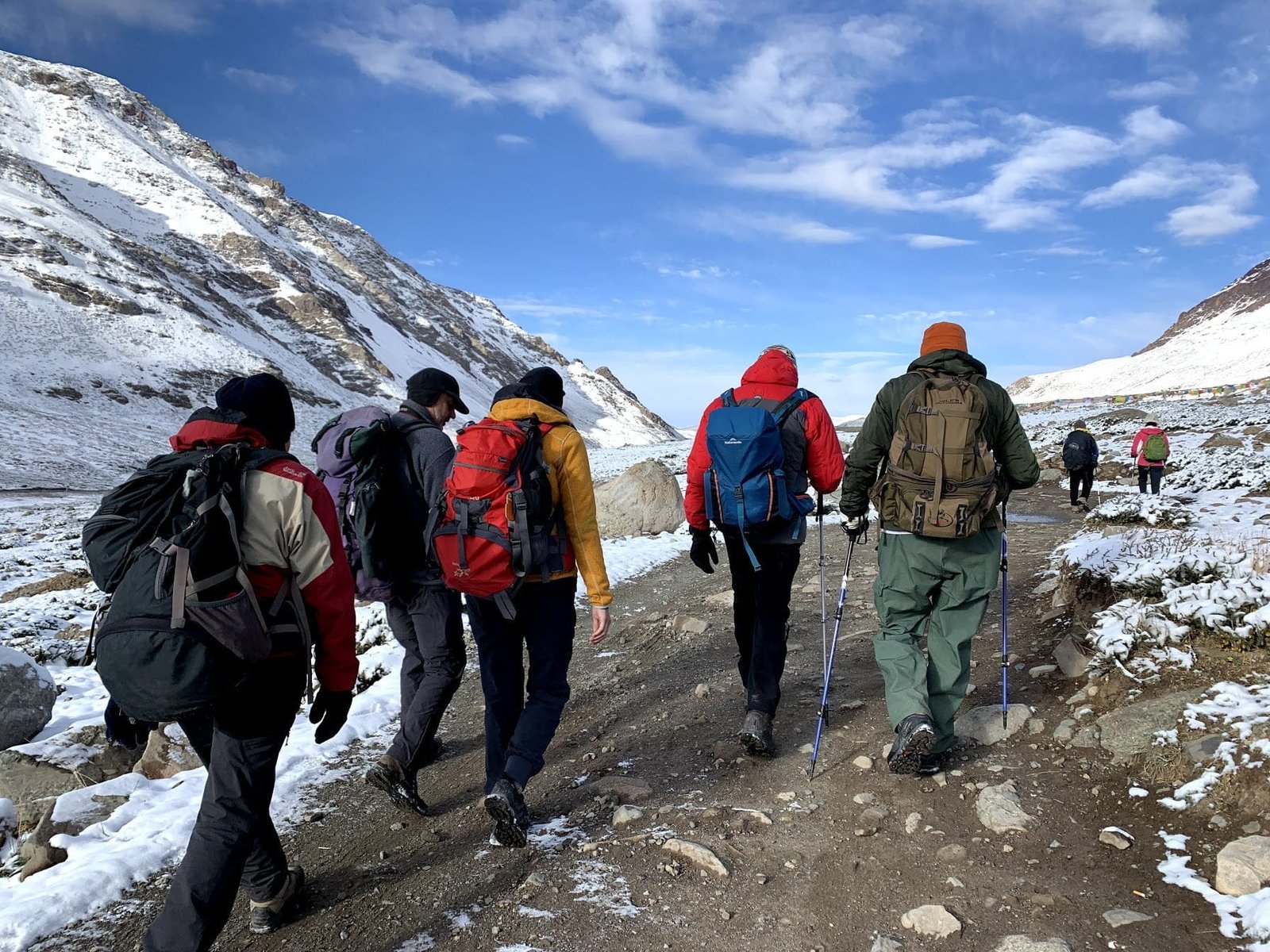
Your journey begins at Everest Base Camp, already standing at an impressive 5,200 meters. From here, you set out toward C1 Camp near the East Rongbuk Glacier. The 5 km trail introduces you to the stark beauty of high-altitude terrain—vast gravel slopes shaped by ancient glaciers. The air is thin, and every step requires steady pacing, but the reward is immediate: sweeping views of ice formations and distant snow peaks.
Today’s trek takes you deeper into the wild Himalayan environment. The route becomes more rugged, with uneven paths and occasional glacier meltwater streams. As you move forward, the scenery grows even more dramatic. Towering peaks and glacial valleys surround you, offering endless opportunities for photography and quiet reflection.
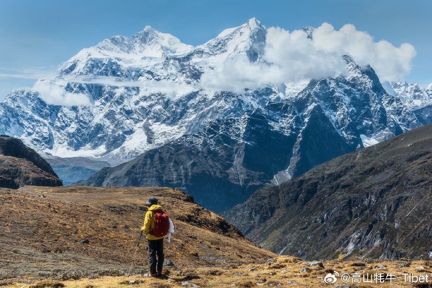
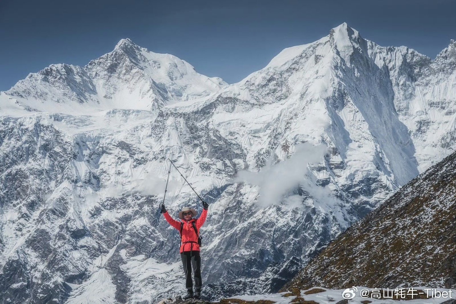
This is one of the most visually stunning sections of the trek. You walk alongside the majestic Rongbuk Glacier, known for its striking blue ice and dramatic formations. As you ascend, the famous “ice tower forest” begins to appear—an incredible natural formation of towering ice structures that feels almost otherworldly.
This is the most challenging and rewarding day of the trek. You ascend to the Advanced Camp at 6,400 meters, the highest point of the journey. The climb is steady but demanding due to altitude. Upon arrival, you are surrounded by vast Himalaya silence and unmatched views. After spending time acclimatizing and absorbing the moment, you descend back to C2 for the night.
Day 5 marks your descent from the Advanced Camp. The exact duration for this return journey to C2 camp may vary depending on your individual pace and how well you’ve acclimatized. This day offers an opportunity to appreciate the surroundings you’ve conquered before heading back to the tent area of Mount Everest Base Camp.
This Everest Base Camp to Advanced Camp trek is a once-in-a-lifetime adventure that requires physical fitness and mental resilience. Proper acclimatization and trekking gear are essential for a safe and successful journey. Experience the exhilaration of conquering high-altitude terrain and witnessing the majesty of Everest up close.
The last morning in Lhasa is free and unhurried. A walk through a familiar street, a final cup of butter tea at a local tea house, or a quiet moment in the city — however you choose to spend it, the time is yours.
When the moment comes, your driver transfers you to Lhasa Gonggar Airport or the train station for your onward journey.
This high-altitude trek from Mount Everest Base Camp to the Advanced Camp is best suited for travelers with good physical fitness and prior hiking experience. Due to the extreme altitude, proper acclimatization before starting the trek is essential for safety and comfort. The route mainly follows gravel paths formed by glacier movement, with only a few short steep sections, making it a non-technical yet physically demanding journey.
Along the way, trekkers should be aware that glacier meltwater may appear on the trail below 5,800 meters, particularly during spring and summer. Maintaining a steady pace is important, and it’s advisable to limit frequent stops for photography during the ascent, as this can disrupt your rhythm and drain energy. Instead, plan to capture more photos during the descent when your body is better adjusted and the pressure of climbing is reduced.
For those looking to enrich the experience, consider extending your stay around Mount Everest Base Camp to further explore the surrounding landscapes. This trek can also be combined with a broader overland journey across the Everest region in Tibet, offering deeper cultural and scenic immersion. Photography-focused add-ons are another excellent option, allowing you to fully capture the beauty of the Rongbuk Glacier and the dramatic high-altitude environment.
Here are our contact options for your convenience:
Feel free to reach out anytime!
Yes, you have the option to cancel your tailor-made tour. However, be aware that cancellation charges will be applied as per the Tour Tibet cancellation policy. For detailed information, please review our Terms and Conditions.
Arranging a tour in Tibet independently is not possible due to the mandatory Tibet Travel Permit. This essential document is a requirement for all foreign visitors traveling to the region and can only be obtained through a local travel agency authorized by the Tibet Tourism Bureau.
Absolutely! We encourage you to visit our office and discuss your travel plans directly with our experienced travel consultants. Together, we can create a tailor-made Tibet tour that suits your preferences and requirements.
After confirming your tour arrangements, a deposit of 20% of the total trip cost is required to secure your booking. This deposit can be made via PayPal, Credit Card, Western Union, or Wire Transfer. The remaining balance is due at the start of your tour.
