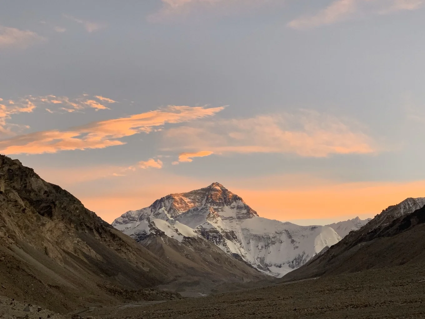
On the vast Qinghai-Tibet Plateau — famously known as the “Roof of the World” — lies one of Earth’s most extraordinary natural wonders. The Yarlung Tsangpo Grand Canyon is not just the largest canyon in China. It is the largest and deepest canyon on the entire planet, surpassing the Colorado Grand Canyon in the United States, the Colca Grand Canyon in Peru, and the Parung Tsangpo Grand Canyon.
Its scale, depth, biodiversity, and geological history make it a landmark of global significance — and one of Tibet’s most compelling destinations.
What Makes the Yarlung Tsangpo Grand Canyon So Remarkable?
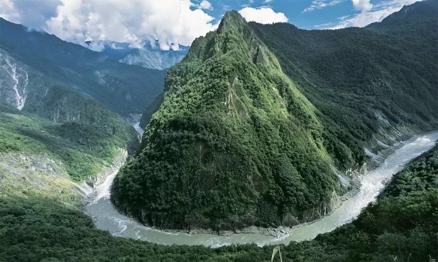
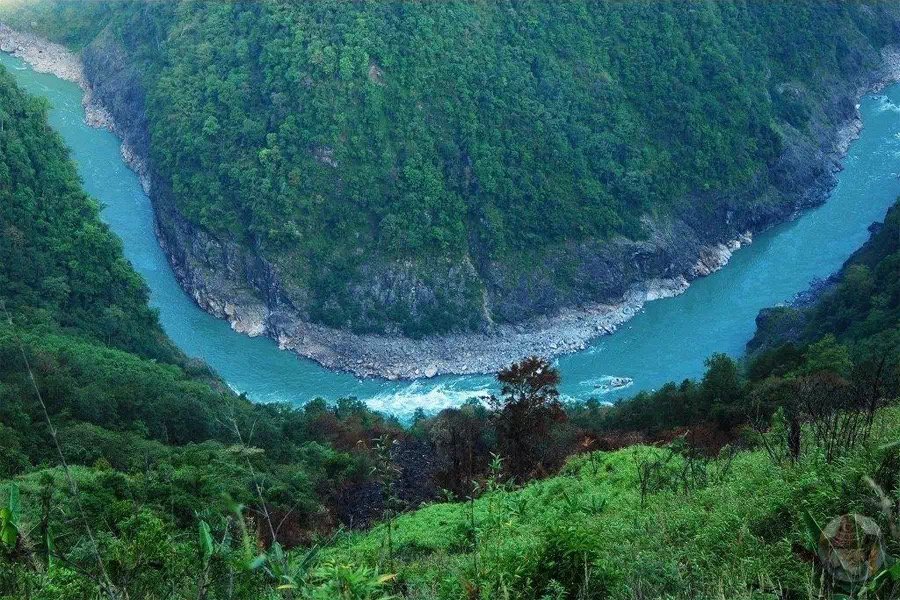
The canyon traces the path of the Yarlung Zangbo River — also known as the Brahmaputra River — as it winds southeastward through high valleys at altitudes exceeding 6,000 meters. The river carves a distinctive U-shaped bend around the mighty Namchakbarwa Peak, creating a dramatic natural corridor unlike anything else on Earth.
According to data from the National Bureau of Surveying and Mapping, the canyon:
- Starts at Daduka Village in Payi Town, Milin County, at an elevation of 2,880 meters
- Ends at Basika Village, Medog County, near Assam, India
- Stretches a total length of 504.6 kilometers
- Reaches a maximum depth of 6,009 meters
- Has an average depth of 2,268 meters
- Contains the narrowest section of just 35 meters wide
Beyond its sheer size, the canyon contains nine vertical natural zones — ranging from alpine ice and snow at the top to tropical rainforests at the base. This makes it the most complete alpine vertical ecosystem anywhere in the world.
How Was the Yarlung Tsangpo Grand Canyon Formed?
The formation of this geological marvel is the result of two powerful and interconnected forces working over millions of years.
Stage One: Tectonic Uplift
The first force is the internal movement of tectonic plates. Over the past 3 million years, the region experienced one of the fastest rates of crustal uplift on Earth — as much as 30 millimeters per year over the last 150,000 years. Geological surveys have identified upwelling asthenospheric mantle bodies beneath the surface as the fundamental driver of this dramatic uplift. In this sense, the formation of the Yarlung Tsangpo Grand Canyon closely parallels the geological history of the Colorado Grand Canyon.
Stage Two: River Erosion and Scouring
The second force is external — the relentless erosive power of the Brahmaputra River. Fed by abundant monsoon rainfall and glacial meltwater, the river carved deeply into the uplifted fault zone, creating enormous altitude variations between the valley floor and surrounding peaks. Over time, geostrophic deflection shaped the river’s course into the large horseshoe-shaped bend that defines the canyon today.
Together, these two forces — tectonic uplift from below and river erosion from above — produced the spectacular landscape visible in the canyon today, with lasting effects on regional climate, geology, landforms, and biodiversity.
The Journey of the Yarlung Zangbo River
In Tibetan, “Yarlung Tsangpo” means water flowing down from the summit — a name that perfectly captures the river’s extraordinary journey.
The river begins at the Genma Yangzong Glacier, at the northern foothills of the Himalayas in southwestern Tibet. In its upper reaches, it is called the Horse River, flowing west to east through southern Tibet before encountering the eastern tip of the Himalayas at Namjagbarwa Peak. There, the river makes a dramatic southward turn and exits Tibet through Basika.
Upon entering India’s Assam state, it becomes the Brahmaputra River. Crossing into Bangladesh, it is called the Jamuna River. Finally, it merges with the Ganges to form the largest river delta in the world before flowing into the Bay of Bengal.
This single river travels through multiple countries, carries multiple names, and shapes entire ecosystems along the way — a testament to its extraordinary geographical reach.
Biodiversity: A World Within a Canyon
The Yarlung Tsangpo Grand Canyon is not only a geological wonder — it is also a biodiversity hotspot. Its range of ecosystems, from tropical to polar, makes it home to the most diverse mountainous ecosystem in the world.
Rare and notable species found within the canyon include the fern erne tree, moss, Yunnan iron cedar, giant boa, Bangladesh tiger, long-leaf tail monkey, and bear monkey.
The canyon also serves as a vital moisture passage from the Indian Ocean into the inner mountainous regions of the Qinghai-Tibet Plateau, creating a green, lush corridor in an otherwise high-altitude, arid landscape.
In 1994, scientists from the Chinese Academy of Sciences formally confirmed it as the largest canyon in the world. This was further supported by GPS measurements taken in October and November 1998, and on October 10th of that year, the State Council of China officially named it the “Yarlung Tsangpo Grand Canyon.”
A Living Archaeological Site
Human habitation of the canyon stretches back 5,000 to 8,000 years. Sophisticated stone tools discovered within the canyon — similar to those found on the northern slopes of the Himalayas — suggest that this region was both a habitat for early Tibetan ancestors and an important route connecting highland and lowland peoples.
Today, thousands of Luoba and Menba people still live within the canyon. Their traditional customs — including tribe totems, witchcraft, and religious rituals — have been preserved over generations, earning recognition as precious living archaeological heritage.
Where Exactly Is the Yarlung Tsangpo Grand Canyon?
The canyon is located in the southeastern part of Nyingchi Prefecture, where the Himalaya, Tanggula, and Hengduan Mountains converge. It begins in Milin County, extends eastward, curves south around Namchakbarwa Peak, and continues southward to Xilang in Medog County.
The core section of the canyon has an average depth of 2,673 meters, while the highest elevation difference on a single side reaches 7,057 meters. With a latitude elevation exceeding 3,000 meters and a total canyon depth surpassing 6,000 meters, it holds the title of the world’s foremost grand canyon by every measurable standard.
Best Time to Visit the Yarlung Tsangpo Grand Canyon
The canyon is accessible for tourism and trekking from early June to mid-October. After October, heavy snowfall closes the mountain roads into Medog County, and access remains unavailable until the following June.
April and October are the most recommended months, offering lower rainfall in the canyon region and a reduced risk of landslides or mudslides. During the rainy season from June to August, some access routes can become hazardous, though the canyon remains open for visitors willing to take the challenge.
A Hub for Science, Tourism, and Exploration
Once a remote and largely inaccessible canyon hidden in inner Tibet, the Yarlung Tsangpo Grand Canyon has emerged as a world-class scenic destination and a vital site for geographical study, scientific research, and adventure tourism. Its combination of geological drama, ecological diversity, cultural heritage, and sheer visual scale makes it one of the most compelling natural sites on the Qinghai-Tibet Plateau.